
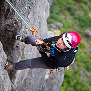


GHOST RIVERS expedition
What possible bug could have bitten seven cavers for them to choose to return to a triangular-shaped plateau surrounded by two deep gorges where not one drop of water flows during the dry season? A difficult proposition to believe given that the area receives more than 12 meters of rain per year, and where most of the deep gorges are scoured by fast-running rivers and streams whatever the season. This weird phenomenon occurs in the Nakanai Mountains, the legendary mountain range in New Britain, one of Papua New Guinea's many islands.
June 6 2018
Caving
Rewind to two years ago. At the beginning of 2016, a team of led by Jean-Paul Sounier decided to explore the karst landscape stuck between Wunung Gorge and Lolotu Gorge. During their successful "Black Hole" expedition, they explored several caves, including one more than 700 meters deep. However, none led to a collection basin. Where then does the water go when it enters the plateau's many dolines and cavities?
The mysterious nature of the meandering underground network incited Jean-Paul to embark on a new project that he named the"Ghost Rivers" expedition.
The following photo trip report show the highlights of an expedition that literally meandered through the heart of the Nakanai Mountains in Papua New Guinea.
The hike to camp
After several days of rain, we finally set off to our high camp. A Malaysian company farms palm trees in the area for palm oil and has hired several adults from local villages; the lack of available porters clearly has an impact on our efforts.
The Moré Cave collection basin
February 20, our last day exploring. David and Clément are with me. At the bottom of a depression in the forest, we discover the opening to a ten-meter deep shaft. Water had carved distinct grooves in the ancient calcite flows, exposing the stratification from their formation. The grooves strangely resembled tree rings, the only difference being that for the latter water contributes to their growth, where as for the scar-ridden calcite flows, water contributed both to their formation and to their partial destruction.
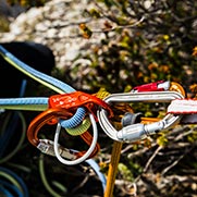
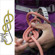
As I bolt the vertical shaft I cannot help but admire the eroded calcite flow that decorates the cave walls. A few meters further down, I am on all fours crawling through a narrow passageway that David had cleared. Beyond that point, we move from one incredible surprise to another.
Two small underground streams empty into the gallery we enter after the narrow passageway. The conduit gets bigger and bigger. Excited, we cover the next twenty meters quickly, and then stop at the water-choked vertical shaft down which the stream falls. There are in fact two shafts, and we bolt the dry one of course. However, they merge together just a bit lower, and we finish beneath a steady flow of water!
Beyond this vertical 17-meter shaft, we pass over a jumble of boulders. The gallery measures three meters by three meters at first, but soon the ceiling starts to lower. In addition, a small lake fills the floor of this soon-to-be crawlspace. We scramble on all fours for the next ten meters. The gallery veers left, and then a tributary from the left adds to the flow of our little stream, the ceiling suddently rises as the walls pull back, and we realize that we are entering exactly what we had been searching for in vain on the plateau: a collection basin!
Careful study and analysis of the topography indicates that Moré Cave is 225 meters deep and one kilometer long; the deepest cavity we explored during the expedition.
The team
Jean-Paul Sounier, team leader,
David Parrot,
Clément Flouret,
Bruno Hugon,
Pierre Valton,
Gérard Garnier,
Jean-François Fabriol, photographer.
Included in this article
Related News